
Anúncios
Measuring land accurately is essential for property owners, farmers, real estate professionals, and construction experts who need precise data to make informed decisions.


Whether you’re planning a new construction project, dividing inherited property, calculating agricultural yields, or simply verifying boundary lines, understanding how to measure land correctly can save you time, money, and legal headaches. The process has evolved dramatically over the centuries, from simple rope and chain methods to sophisticated GPS technology that fits in your pocket.
Modern technology has democratized land measurement, making what was once the exclusive domain of professional surveyors accessible to anyone with a smartphone. Today, you can measure terrains with remarkable accuracy using dedicated apps, satellite imagery, and GPS-enabled devices that deliver professional-grade results in minutes rather than days.
📏 Understanding the Fundamentals of Land Measurement
Before diving into specific methods and tools, it’s crucial to understand what you’re actually measuring when you assess a piece of land. Land measurement typically involves calculating area (the two-dimensional space a property occupies), perimeter (the distance around the boundary), and sometimes elevation or topographical features.
Different projects require different levels of accuracy. A farmer estimating fertilizer needs might work with measurements accurate to within a few percentage points, while a legal property survey for a real estate transaction demands precision down to inches or centimeters.
The units of measurement also vary by region and purpose. In the United States, acres and square feet dominate, while most of the world uses hectares and square meters. Understanding these conversions is essential when working across different contexts or consulting various sources.
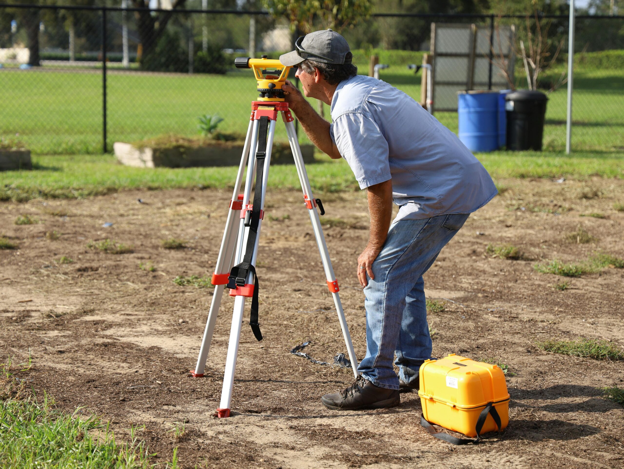
🗺️ Traditional Methods That Still Hold Value
Despite technological advances, traditional land measurement techniques remain relevant, particularly in areas with limited technology access or when you need to verify digital measurements.
The Tape Measure Approach
For small, rectangular plots, a simple measuring tape can provide adequate accuracy. This method works best for residential lots, garden spaces, or small construction sites where you can physically walk the boundaries. The key is measuring all sides carefully and accounting for any irregular angles or curves.
To calculate area using this method, measure the length and width of rectangular sections, multiply them together, and add up all sections. For triangular areas, measure the base and height, then multiply and divide by two.
Wheel Measuring Devices
Measuring wheels, also called surveyor’s wheels or distance measuring wheels, offer a practical middle ground between basic tape measures and high-tech solutions. You simply walk the perimeter while the wheel counts rotations and calculates distance. These devices are particularly useful for measuring boundaries on relatively flat, walkable terrain.
🛰️ GPS Technology: The Game-Changer in Land Measurement
Global Positioning System technology has revolutionized how we measure land, bringing professional-level accuracy to consumer devices. Modern smartphones contain GPS chips capable of pinpointing your location to within a few meters under good conditions, and specialized GPS units can achieve centimeter-level precision.
GPS-based measurement works by recording coordinates at various points around a property’s boundary, then calculating the enclosed area using geometric algorithms. This method excels at measuring irregular shapes that would be challenging with traditional techniques.
The accuracy of GPS measurements depends on several factors: satellite visibility, atmospheric conditions, device quality, and whether you’re using standard GPS or augmented systems like DGPS (Differential GPS) or RTK (Real-Time Kinematic) positioning.
📱 Mobile Apps: Professional Surveying in Your Pocket
Smartphone applications have made land measurement accessible to everyone. These apps leverage your phone’s GPS capabilities, often combining them with satellite imagery and sophisticated algorithms to deliver surprisingly accurate results.

Using a land measurement app typically involves walking around the perimeter of the property while the app records GPS waypoints. Once you’ve completed the circuit, the app calculates the total area, perimeter, and often provides additional data like coordinates for each point.
Quality land measurement apps offer features like manual point placement for inaccessible areas, the ability to save and export measurements, unit conversion, and integration with mapping services. Some can even calculate distances and areas directly from satellite imagery without requiring you to physically walk the property.
Key Features to Look For
- GPS accuracy indicators: Shows you the current precision level of your measurements
- Multiple measurement units: Easily switch between acres, hectares, square feet, and meters
- Offline functionality: Work in areas without cellular coverage
- Data export options: Share measurements via PDF, KML, or other formats
- Manual correction tools: Adjust points when GPS signal is compromised
- Multiple property tracking: Save and manage measurements for different locations
🌾 Practical Applications Across Different Industries
Land measurement serves diverse purposes across multiple sectors, each with unique requirements and challenges.
Agricultural Planning and Management
Farmers need accurate field measurements to calculate seed requirements, fertilizer application rates, irrigation coverage, and yield estimates. Knowing the precise size of different fields helps optimize crop rotation and resource allocation. Modern precision agriculture relies heavily on accurate land measurement combined with GPS-guided equipment.
Real Estate and Property Development
Real estate professionals use land measurements to accurately describe properties, calculate property taxes, determine development potential, and establish fair market values. Buyers and sellers both benefit from precise measurements that eliminate disputes and ensure transparent transactions.
Construction and Engineering Projects
Construction projects begin with accurate site measurements that inform design decisions, material calculations, and project budgets. Engineers need precise topographical data to plan drainage, grading, and structural placement. Even small measurement errors can compound into significant cost overruns.
Environmental Conservation
Conservation organizations measure land to assess habitat size, monitor deforestation, plan restoration projects, and document protected areas. Accurate measurements support grant applications and help track conservation impact over time.
⚖️ Legal Considerations and Professional Surveys
While consumer tools provide excellent estimates for planning and general purposes, legal property transactions typically require professional land surveys conducted by licensed surveyors. These professionals use specialized equipment and follow strict protocols to create legally defensible boundary descriptions.
Professional surveys establish official property lines, identify easements and encroachments, and create documentation that holds up in court. They’re usually required for property purchases, subdivisions, and resolving boundary disputes.
However, using consumer measurement tools before commissioning a professional survey can help you understand your property better, identify potential issues early, and communicate more effectively with surveyors about your needs.
🎯 Tips for Achieving Maximum Accuracy
Whether you’re using a smartphone app or traditional methods, certain practices will improve your measurement accuracy significantly.
Optimize GPS Signal Quality
GPS accuracy improves dramatically in open areas with clear sky visibility. Tall buildings, dense tree cover, and steep terrain can interfere with satellite signals. When possible, take measurements during optimal conditions and wait for your device to acquire strong satellite locks before starting.
Walk Carefully and Consistently
When walking a perimeter with GPS equipment, stay as close to the actual boundary as safely possible. Walk at a steady, moderate pace to give the device time to record accurate positions. Rushing or erratic movement can introduce errors.
Take Multiple Measurements
Repeating measurements and averaging the results helps compensate for GPS variability and human error. If possible, measure at different times of day or on different days to account for varying satellite configurations and atmospheric conditions.
Document Reference Points
Note distinctive landmarks, existing markers, or other reference points during your measurement. These help verify accuracy and allow you to recreate measurements if needed. Photographs of corner points and boundaries provide valuable documentation.
🔍 Common Mistakes to Avoid
Even with excellent tools, certain errors can compromise your measurements. Being aware of these pitfalls helps you avoid them.
Ignoring boundary irregularities: Natural boundaries like streams or tree lines often curve and shift. Don’t assume straight lines where they don’t exist.
Forgetting about easements: The legal property boundary may differ from physical features or fences. Easements and right-of-ways can affect usable area.
Mixing measurement units: Accidentally combining acres with hectares or feet with meters produces wildly inaccurate calculations. Always verify your units before finalizing measurements.
Relying on poor GPS conditions: Measuring under heavy tree canopy, next to tall structures, or during poor weather can severely compromise GPS accuracy. Wait for better conditions when precision matters.
Neglecting terrain effects: Sloped land has more surface area than flat land with the same horizontal footprint. For very hilly properties, consider whether you need surface area or projected horizontal area.
📊 Converting Between Different Units
Land measurements use various units depending on location and tradition. Understanding common conversions helps you interpret measurements from different sources.
| From | To | Multiply By |
|---|---|---|
| Acres | Hectares | 0.404686 |
| Hectares | Acres | 2.47105 |
| Square Feet | Square Meters | 0.092903 |
| Square Meters | Square Feet | 10.7639 |
| Acres | Square Feet | 43,560 |
| Hectares | Square Meters | 10,000 |
🌟 The Future of Land Measurement Technology
Land measurement technology continues evolving rapidly. Drone-based surveying now allows detailed terrain mapping from aerial perspectives, capturing elevation data and creating 3D models of properties. These aerial surveys can cover large areas quickly while capturing details impossible to see from ground level.
Augmented reality applications are emerging that overlay property boundaries and measurement data onto your view through your phone’s camera, making abstract boundary lines visible in the real world. This technology helps visualize property limits and planned developments in ways that traditional maps cannot.
Artificial intelligence and machine learning algorithms are improving automatic boundary detection from satellite imagery, potentially allowing instant property measurements without any fieldwork. These systems can already identify field boundaries, building footprints, and land use changes with impressive accuracy.
💡 Choosing the Right Method for Your Needs
The best land measurement approach depends on your specific situation, required accuracy, budget, and timeline. For quick estimates of large rural properties, GPS apps provide excellent value. Small urban lots might be measured adequately with a tape measure and basic geometry.
When legal precision is essential—for property transactions, boundary disputes, or subdivision—invest in a professional survey. The cost is modest compared to potential legal complications from inaccurate boundaries.
For ongoing management of agricultural land or multiple properties, specialized GPS equipment or subscription-based measurement services may justify their higher costs through improved accuracy and efficiency.
🚀 Getting Started with Your First Measurement
Ready to measure your property? Start by clearly identifying what you need to measure and why. Different purposes may require different approaches. Gather any existing property documents, old surveys, or deeds that might contain boundary descriptions or reference points.
Choose your measurement tool based on property size, terrain, and accuracy requirements. For most general purposes, a quality GPS measurement app provides an excellent starting point with minimal investment.
Before measuring, walk the property to identify the boundaries and note any obstacles or areas where access might be difficult. This reconnaissance helps you plan your measurement route and identify where you might need to improvise.
When you’re ready to measure, ensure your device has a strong GPS signal, calibrate according to the app’s instructions, and methodically work around the entire perimeter. Take your time—accuracy improves with patience and careful attention to detail.
🔧 Troubleshooting Common Measurement Issues
When measurements seem incorrect, systematic troubleshooting can identify the problem. First, verify your GPS accuracy indicators—many apps show current precision in meters or feet. If accuracy is poor, wait for better satellite acquisition or move to a more open area.
Compare measurements against known reference points when possible. If you know one side of your property measures exactly 100 feet (perhaps from a previous survey), use this to verify your tool’s accuracy.
For irregular results, check whether you’ve accidentally left measurement mode active while moving between areas, creating unintended points. Review your recorded points and delete any obvious errors before calculating final area.
✨ Empowering Property Owners with Knowledge
Understanding how to measure land effectively puts valuable knowledge in your hands. Whether you’re managing a farm, buying property, planning a garden, or simply satisfying curiosity about your land’s size, accurate measurement provides the foundation for informed decisions.
Modern tools have made this once-specialized skill accessible to everyone. With a smartphone and the right app, you can achieve measurements that would have required expensive professional services just a generation ago. This democratization of surveying technology empowers property owners to take active roles in understanding and managing their land.
The confidence that comes from knowing your property’s exact dimensions helps in countless situations—from calculating lawn care products to planning ambitious development projects. It transforms abstract property descriptions into concrete, measurable reality that you can work with confidently.
As technology continues advancing, measuring land will only become easier and more accurate. But the fundamental principles remain constant: understanding what you’re measuring, choosing appropriate tools, applying proper techniques, and knowing when to call in professionals for legally binding results. Master these basics, and you’ll have valuable skills that serve you throughout your property ownership journey.